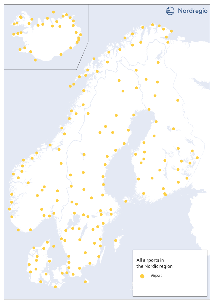
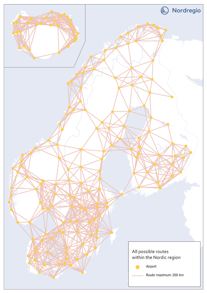
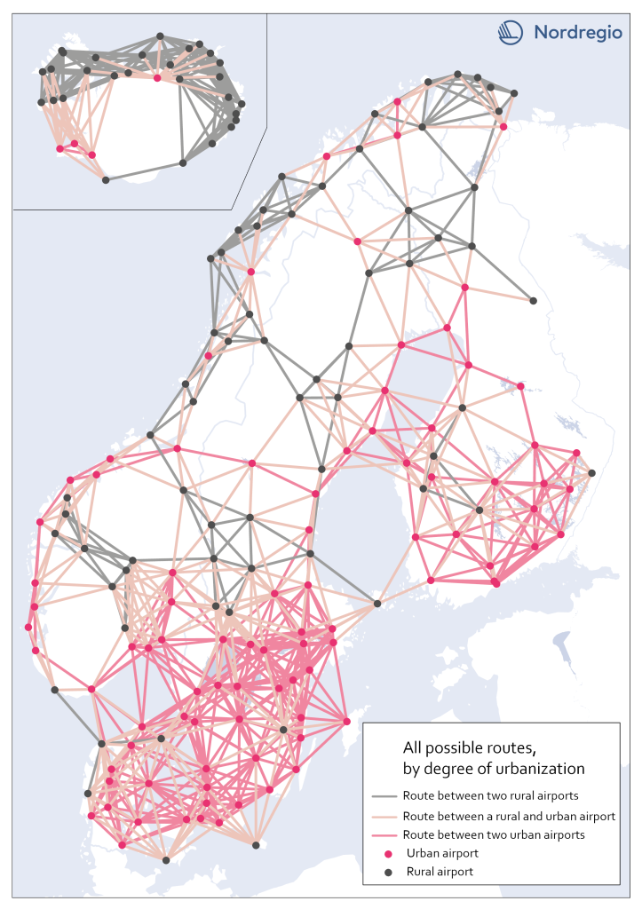
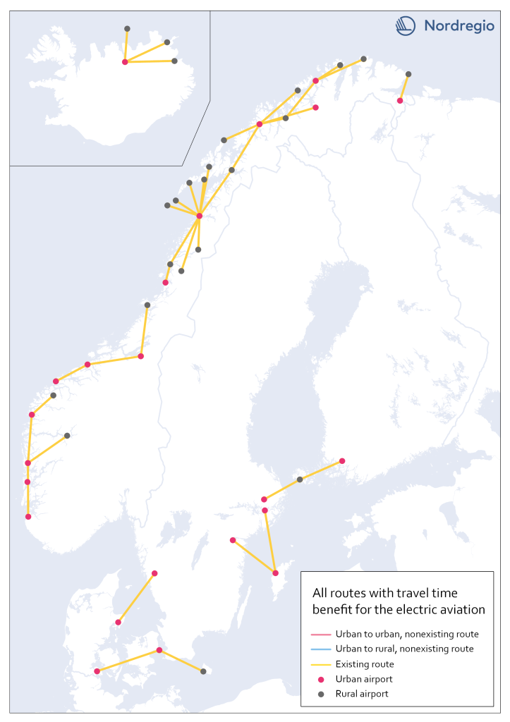
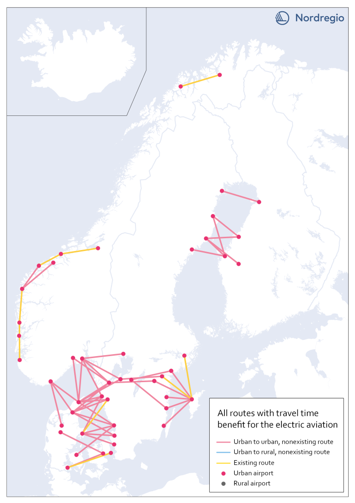
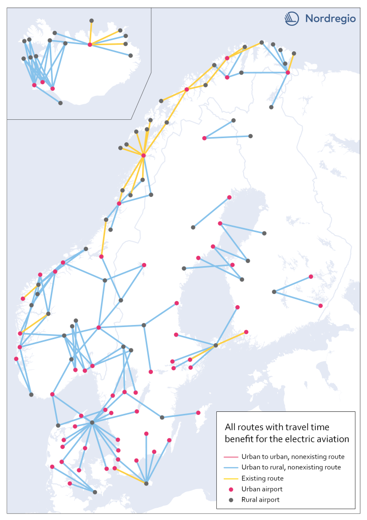
Maps
During the project, we identify various demands for electric aviation between and across Nordic countries. On this page, you can access a series of maps highlighting the areas that could benefit the most from using electric aviation.
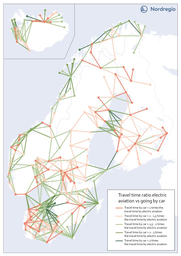
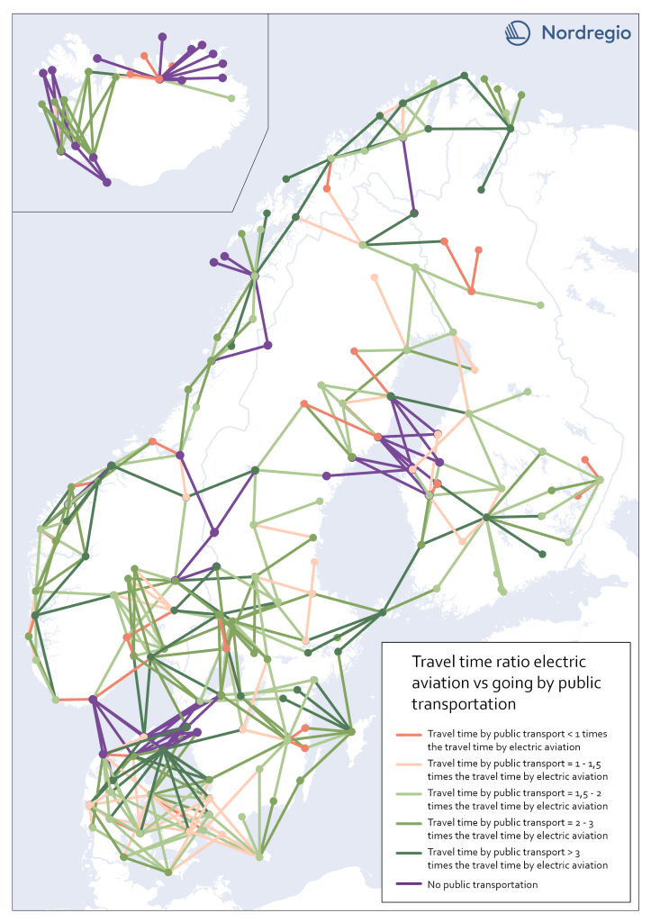
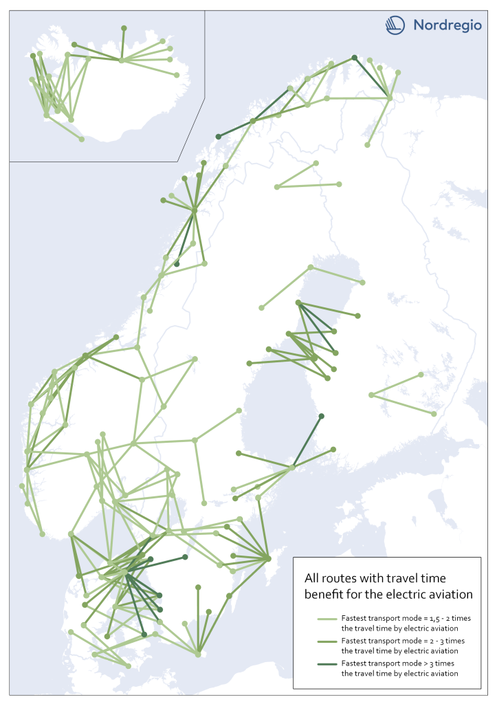
Accessibility study for electric aviation
The following maps are a part of the accessibility study. The study compares travel times of various routes by the electric aircraft and the fastest transport mode currently in use. This is done to understand where the implementation of electric aviation could offer the largest accessibility gains. To learn more about the accessibility study, press here.